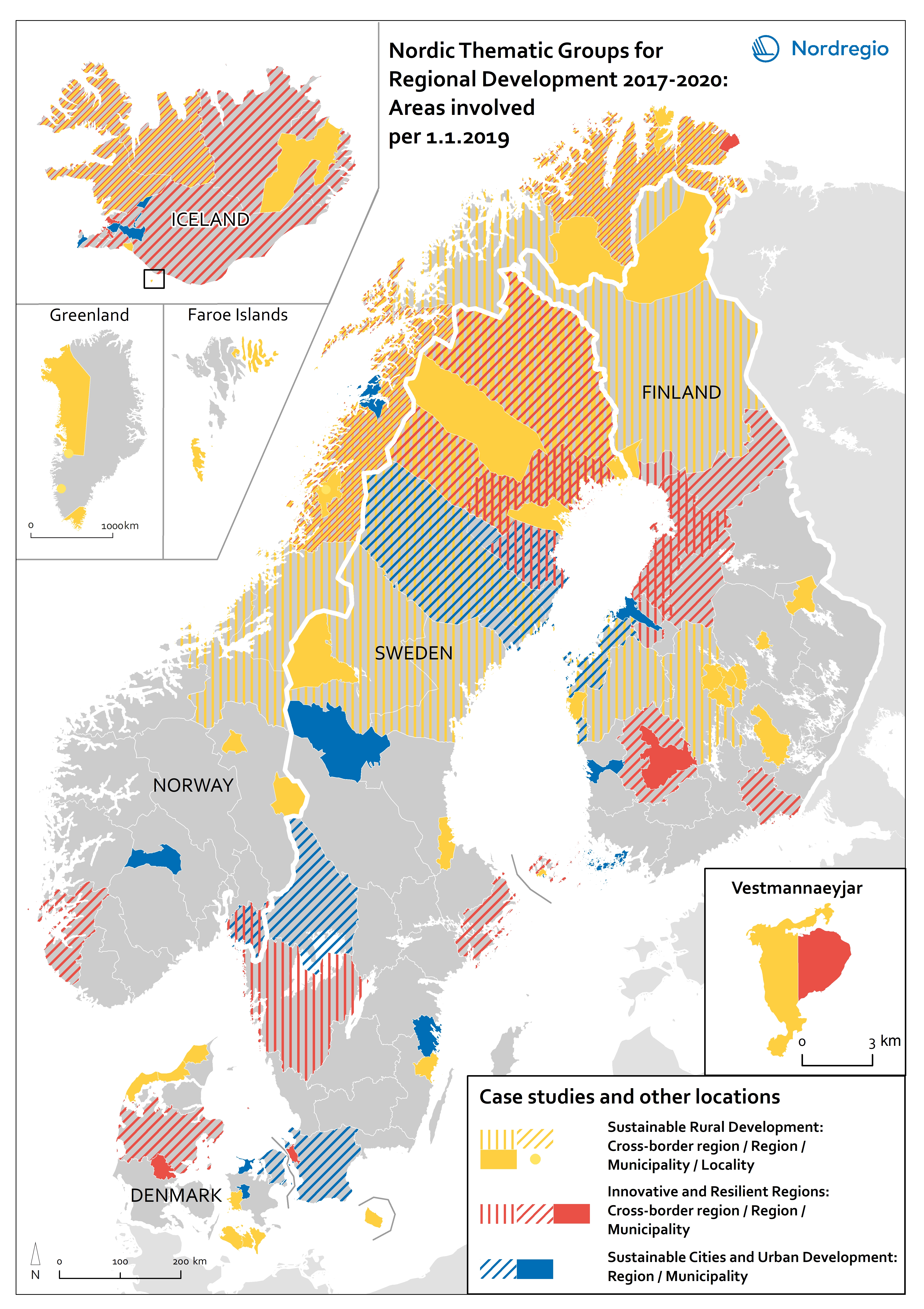
The Nordic Thematic Working Groups for Regional Development 2017-2020 have initiated a broad range of studies all over the Nordic Region. This includes both case studies of specific cities or municipalities, broader studies of entire regions or cross border areas, as well as desk studies and questionnaires.
This map indicates the geographical areas involved in case studies and more in-depth research but does not cover municipalities and other areas involved in e.g. questionnaires or more general studies.

The map divides the three thematic research areas into categories that are illustrated with different colours. Different symbol styles indicate the administrative difference of the studied areas. Yellow depicts the thematic topic of Sustainable Rural Development, red depicts Innovative and Resilient regions and blue Sustainable Cities and Urban Development.
Stripes indicate the cross-border and border committee regions as well as the studied administrative regions. Polygons with filled colours show municipal territories involved in the research. Within the thematic topic of Sustainable Rural Development also a few small localities in Greenland, Faroe Island and Norway were studied. These are depicted with small yellow circles.
Find out more about the Nordic Thematic Groups for Regional Development and Planning 2017-2020 here.

