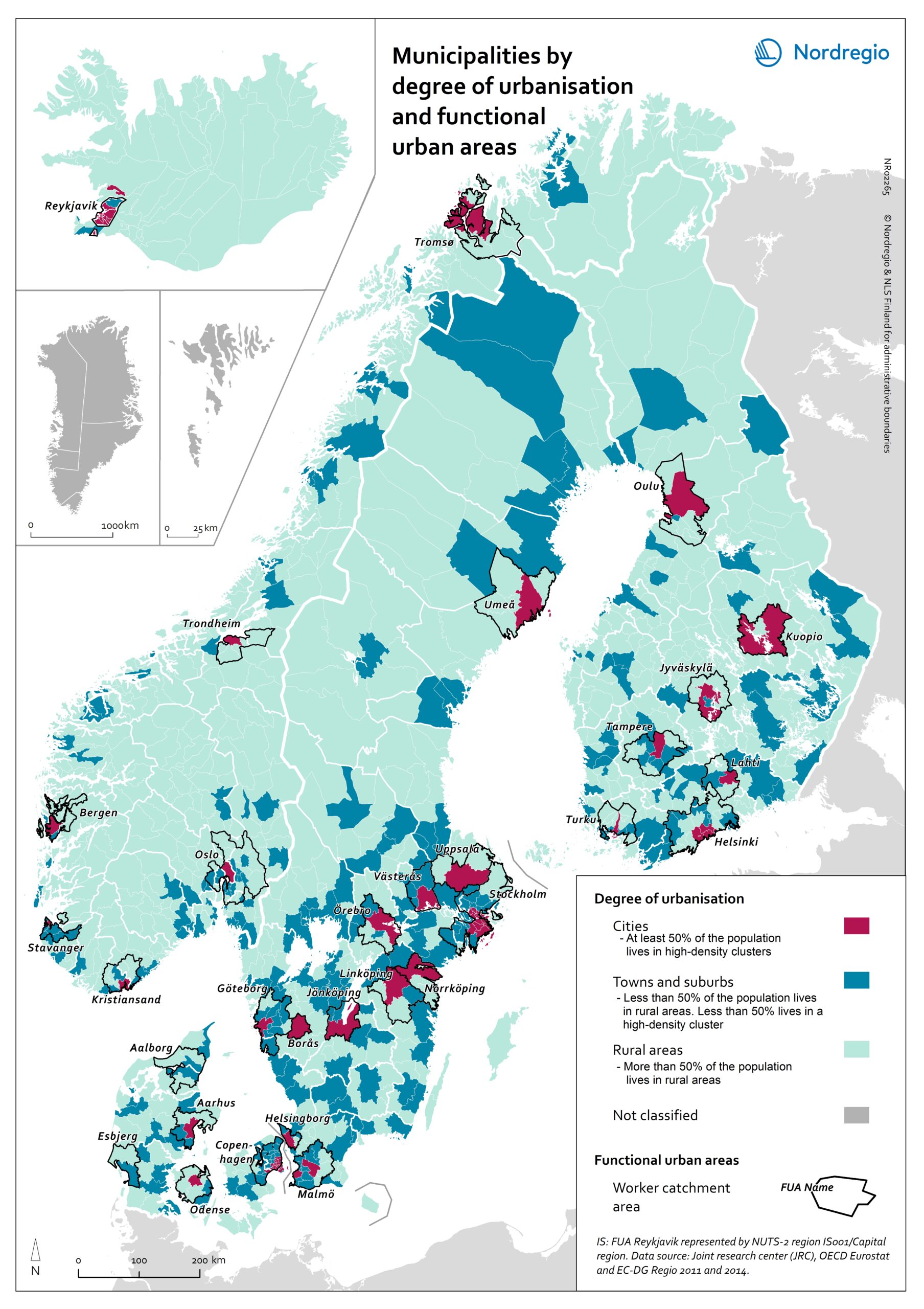
This map shows Nordic municipalities differentiated between their degree of urbanisation. The degree of urbanisation is the relationship between the population living in urban (and rural) areas and the total population of the municipality. The degree of urbanisation is a difficult concept to display but is useful as a way of adding nuance to the debate on urban-rural relations. The map also displays the functional urban areas in the Nordic Region.
Cities with at least 50% of the population living in high-density clusters are highlighted in red. Towns and suburbs with less than 50% of the population living in high-density clusters and in rural areas are highlighted in dark blue. Rural areas with more than 50% of the population living in rural areas are highlighted in light blue. Functional urban areas are circled in black.
The core cities of the 31 urban functional areas in the Nordic Region correspond to the cities as defined by degree of urbanisation. In the functional urban areas of Esbjerg and Aalborg in Denmark, for instance, there are however no densely populated urban centres. The hinterlands in most functional urban areas in the Nordic Region do include towns and suburbs as well as rural areas. Moreover, municipalities in sparsely populated areas can display a high degree of urbanisation, such as, for example, Kiruna and Gällivare in Sweden.
The map is based on data from the Joint Research Center, the OECD Eurostat and EC-DG Region 2011 and 2014. In Iceland, the FUA Reykjavik is represented by NUTS-2 region IS001/Capital region.

