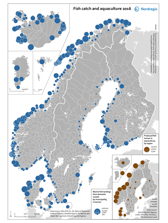
This map shows marine fishing landings from domestic vessels in tonnes by Nordic municipality in 2016. The small map shows the production of fish in aquaculture in tonnes by Nordic Region in 2016.
The blue circles are proportional to the amount of marine fish landings from domestic vessels in 2016. The larger the circle, the greater the amount of marine fish landings from domestic vessels. The brown circles are proportional to the amount of produced fish in aquaculture in 2016. The larger the circle, the greater the amount produced fish in aquaculture.
Fisheries and aquaculture are highly important bioeconomy sectors in the Nordic Region. Norway, particularly its coastal regions in the west, clearly dominates the Nordic aquaculture sector. Fisheries and aquaculture are the most important contributors to the Faroese economy. Fishing is also the most important export sector in Greenland. The Faroe Islands, Iceland and Greenland have huge fish landing amounts per capita.