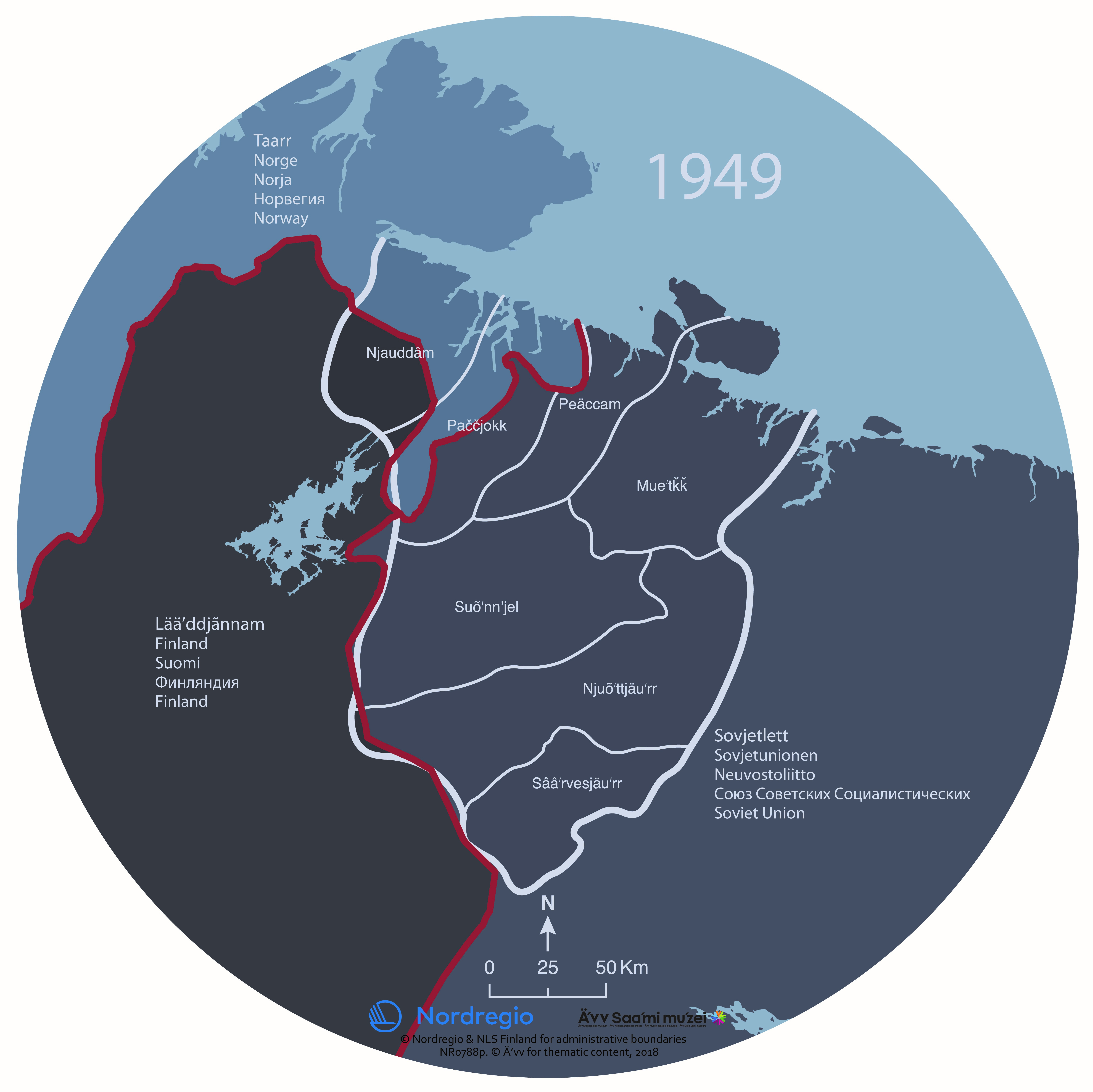
The map shows the Skolt Sámi Land and the borders of national states in 1949. The Skolt Sámi Land is the home area for the indigenous Skolt Sámi people.

During the Second World War, the Skolt Sámi land was the stage of violent acts of war. After the war, borders were again redrawn. The Soviet Union took the Petsamo area from Finland. The Skolt Sámi of Petsamo were given new settlement areas in north eastern Finland. In Norway and the Soviet Union, the Skolt Sámi remained an invisible minority. In all three countries, there was very little space for the Sámi. It took decades before the human rights of the Sámi received any attention.
The map was produced for the exhibition Saaʹmijânnam – The Skolt Sámi Land in Äʹvv Skolt Sámi museum in Neiden, Norway. The map is the result of a collaboration between Äʹvv Skolt Sámi museum (responsible for the reconstruction of the Skolt Sámi areas and the exhibition), Yngvar Julin (concept of maps and exhibition architect), Nordregio (base maps) and Rethink. and illustrator Ruth Thomlevold (graphic design).
Back to the main project page.
Related Staff
Related Research Projects
Related Maps
- Saaʹmijânnam – Borders: 1826
- Saaʹmijânnam – Borders: 1920
- Saaʹmijânnam – the Community: Location of the Skolt Sámi Land
- Saaʹmijânnam – the Community: Location of the Skolt Sámi sijdds
- Saaʹmijânnam – the Community: Location of the Skolt Sámi sijdds with water bodies and elevation
- Saaʹmijânnam – the History: Assumed distribution of ethnic groups around year 500
- Saaʹmijânnam – the History: Taxation and borders in 14th century
- Saaʹmijânnam – the History: The monastery of Petsjenga and the fortress of Kola


