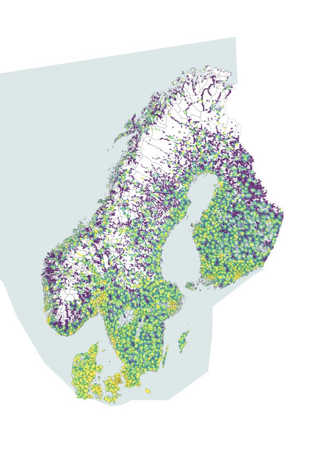
Welcome to the Nordic Service Mapper! This interactive mapping tool visualises the proximity to different types of services, including grocery stores, pharmacies, libraries and schools, across the Nordic Region. Try it out! This mapping tool was produced by Nordregio through the funding from the Nordic Thematic Group on Sustainable Rural Development 2017-2020.

Visit Nordic Service Mapper in a full window for better user experience: www.nordicservicemapper.org

Sources: HERE Technologies (service locations and street data); National spatial data infrastructures (population data on 1,000m grid-level) and OpenStreetMap.

The map shows street-based proximity for the population to various service categories. The coloured areas show the populated areas across the Nordic countries and the colour represents the distance to the nearest service facility in kilometres. The situation reflected is December 2019.

Various data aggregation and normalisation options are provided in the chart tool:

  • by Eurostat degree of urbanisation at municipality level (1. Cities, 2. Intermediate, 3. Rural)
  • by regional or municipal boundary (detailed zoom levels) selections
  • by freehand area selection

The spatial analysis was done in ESRI´s Network analyst (closest facility). All network calculations are cross-border. Bridges, ferry links, road hierarchies and one-way restrictions were included in the analysis.

For enquiries please email us at [email protected]

Print:

Share: