This map shows population density across the European Union, and neighbouring countries, in 2021. Population is visualised with the number of people per 1-kilometre grid cell.
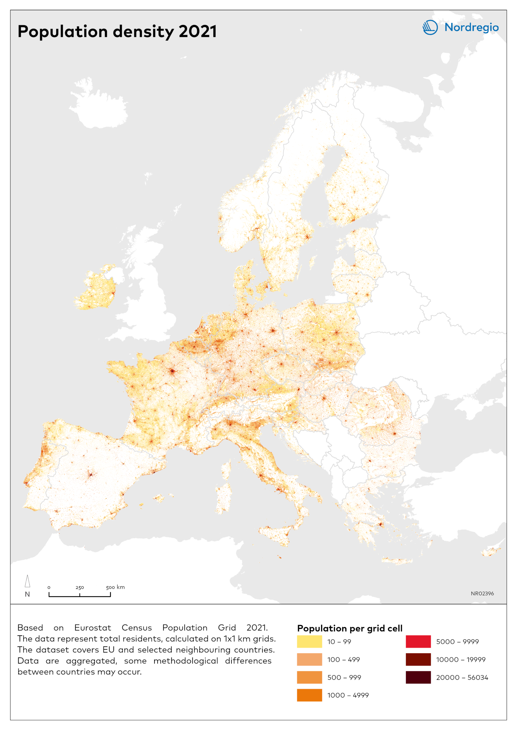
Higher population densities are concentrated in lowland areas, around major cities, along coasts, and in economically integrated corridors. Mountain regions and the northern periphery remain sparsely populated. This is shown in the Scandinavian mountain range, across countries in the Alps, and the Carpathians. The grid data is available for EU countries and “some other neighbor countries” (https://gisco-services.ec.europa.eu/). Gridcells with ten or less people are visualized in white.
Some differences in population distribution across countries appear. At first glance, Spain looks sparsely populated in most parts of the country but is home to almost 50 million people. Most of continental Europe present a continuous population distribution, with exceptions listed above. Another interesting finding is the south-western part of France, facing the Atlantic that shows that looks very sparsely populated. This is due to the Landes de Gascogne, one of Europe’s large forest regions, and the area is one of few coastal areas with low population.The Nordic countries display large areas with no, or less than ten, population per grid cell. The population in the Nordic countries are mainly located along coastal areas. Denmark, however, present a more evenly distributed population distribution with few areas visualised with white.
