This map is included in the introduction of the State of the Nordic Region 2018 report.
8 February, 2018
The map is included in the State of the Nordic Region 2018 report.
Designer/Cartographer
Julien Grunfelder
Data source
Eurostat and Nordregio
Published 8 February 2018
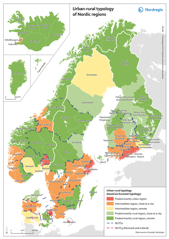
All images are the property of Nordregio. They may be freely used as long as the logo of Nordregio is clearly visible and the source is cited accordingly. Please give also the cartographer/designer/author credit and give full recognition to the data sources if named in the graphic.
Source: Nordregio at www.nordregio.org
