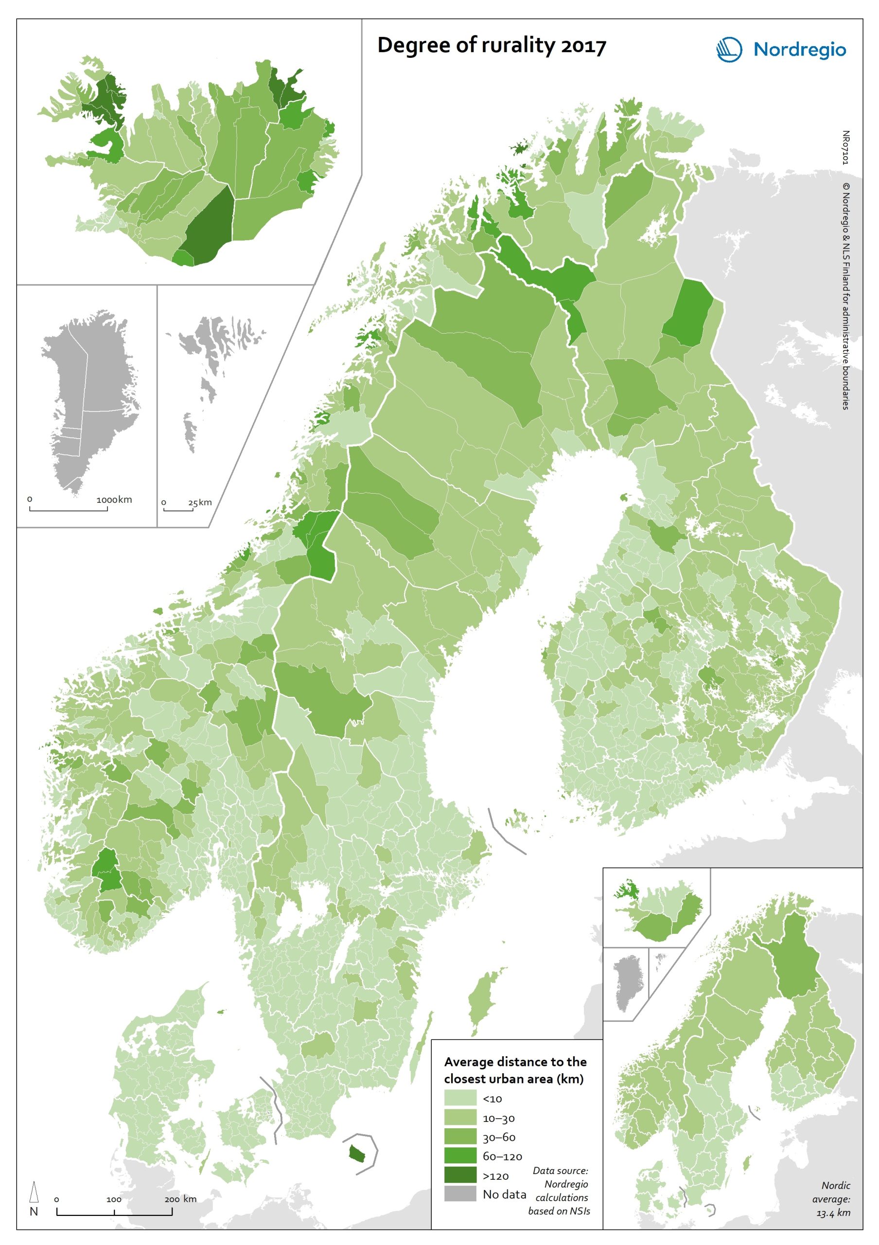
This map shows the average distance to the edge of the closest urban area for the population living outside urban areas in the Nordic municipalities and regions.
These figures are of particular interest in the analysis of urban-rural patterns and the Nordic populations’ access to local services in sparsely population areas. The darker shades on the map indicate longer average distances to the edge of the nearest urban area, and the lighter shades indicate shorter average distances. While almost all Danish municipalities have an average distance of below 10 km from rural grid cells to the nearest urban area, a large share of the municipal populations of the remaining Nordic countries need to contend with longer average distances to local services.
The largest distances can be found in several municipalities of Iceland and Norway (Árneshreppur 230 km, Hasvik 154 km), whereas the largest average distances for Finnish and Swedish municipalities are considerably shorter (Enontekiö 103 km, Storuman 52 km). Regarding within-country variation, shorter average distances can generally be found in southwestern Finland and southern Sweden, in comparison with the more remote parts of these countries. Both Norway and Iceland provide a rather more mixed picture, since there are municipalities with shorter average distances scattered across different parts of each country.
Method used to calculate the degree of rurality
In order to take into account access to services such as grocery stores, pharmacies, schools, community centres and public transport, the European definition of urban grid cells was used to create this map, i.e. a population density threshold of 300 inhabitants per km2 applied to grid cells of 1 km2. The closest distance was calculated from each rural grid cell centroid to the nearest urban grid cell centroid along the existing road network traversable by car, including car ferries, based on population grid data from 2017. Since the municipalities of Gladsaxe, Kauniainen and Sundbyberg are without any rural population (only having urban populations), they were not included in the analysis.


