HomeMapsPopulation change in settlements 2006-2014
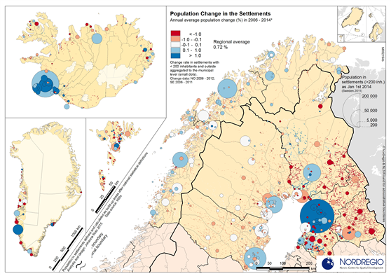
Annual average population change in localities with over 200 inhabitants and outside those in 2006-2014
Map Facts
The map shows the locations of all settlements with 200 inhabitants and more in the Nordic Arctic region, as well as its population change 2006-2014. The population increased annually 0.72% in the region. The larger settlements, and smaller settlements in those commuting catchment area, are in general the main growth poles in the northern part of Norden. At the same time the population living outside the settlements of 200 inhabitants and more is decreasing in lion share of municipalities.
All images are the property of Nordregio. They may be freely used as long as the logo of Nordregio is clearly visible and the source is cited accordingly. Please give also the cartographer/designer/author credit and give full recognition to the data sources if named in the graphic.