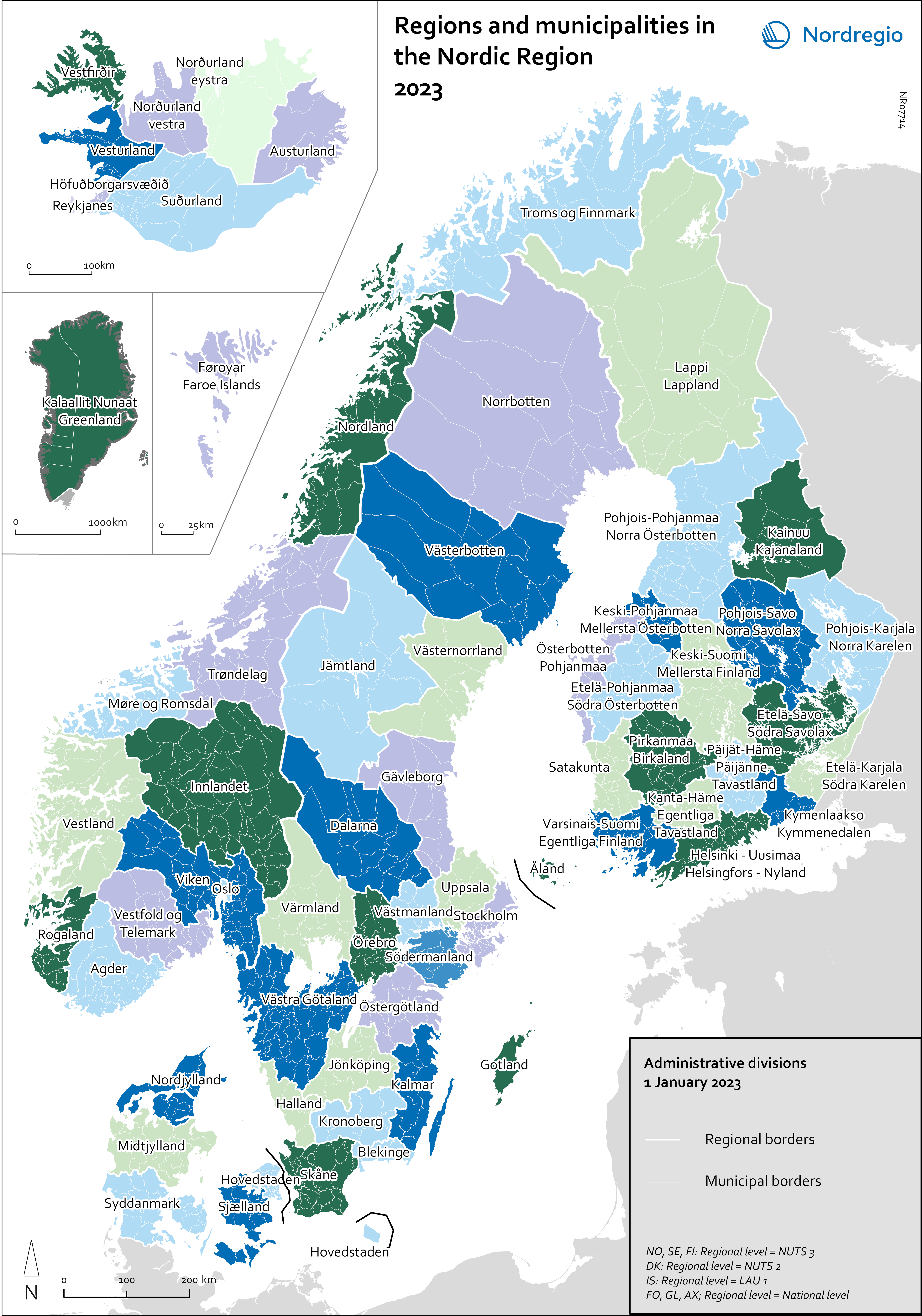
This map shows the municipal and regional borders of the Nordic Region as of 1 January 2023*, the names refer to the regions. The Nordic Region is vast and has a diverse physical geography, stretching from the northern edge of the European mainland to north of the Arctic Circle. It consists of Denmark, Finland, Iceland, Norway and Sweden, as well as the three self-governing regions, the Faroe Islands and Greenland (both part of the Kingdom of Denmark) and Åland (part of the Republic of Finland).
This map shows the municipal and regional borders of the Nordic Region as of 1 January 2023*, the names refer to the regions. The Nordic Region is vast and has a diverse physical geography, stretching from the northern edge of the European mainland to north of the Arctic Circle. It consists of Denmark, Finland, Iceland, Norway and Sweden, as well as the three self-governing regions, the Faroe Islands and Greenland (both part of the Kingdom of Denmark) and Åland (part of the Republic of Finland).
The table below summarises the administrative structure in each of the Nordic countries. These structures form the basis for the Nomenclature of Territorial Units for Statistics (NUTS) classification, a hierarchical system dividing European states into statistical units for research purposes. In general, the NUTS and Local Administrative Units (LAU) classifications follow existing divisions, but this may differ from country to country. Light grey frames represent the regional level presented In Nordregio’s map. As of 1 Jan 2023, there were 66 regions at this level. Dark grey frames show the local units represented in most of the municipal maps. As of 1 Jan 2023 there were 1,133 units at this level.
*There are usually some changes in the administrative borders every year. Since 2023 there have for example been changes in the regional level in Norway as well as some merges of municipalities in Iceland and Finland.
