Main shipping routes in 2015 and ports with onshore power supply (OPS) in 2016
Map Facts
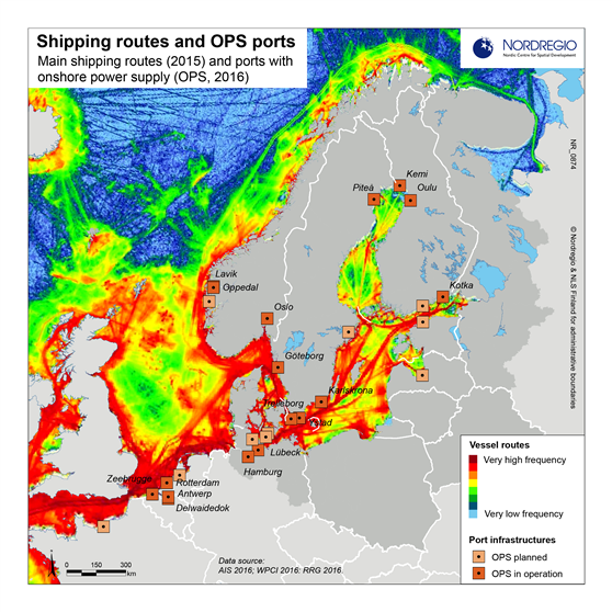
This map shows the frequency of vessel routes in 2015, and the locations of ports with onshore power supply (OPS) in 2016. The preferred shipping routes are unevenly distributed across the BSR, and the same applies to the OPS ports. Areas with the highest density of vessel routes and OPS ports are the Skagerrak, Kattegat, Storebælt, Øresund, the southern Baltic Sea between Denmark, Sweden and Germany, the sea between Gotland and the Swedish mainland, Gdansk Bay, and the Gulf of Finland.
Map id: 0874
Read more about this research
Designer/Cartographer
Shinan Wang
Data source
AIS 2016; WPCI 2016; RRG 2016.
Published 7 November 2016
Terms of use
All images are the property of Nordregio. They may be freely used as long as the logo of Nordregio is clearly visible and the source is cited accordingly. Please give also the cartographer/designer/author credit and give full recognition to the data sources if named in the graphic.