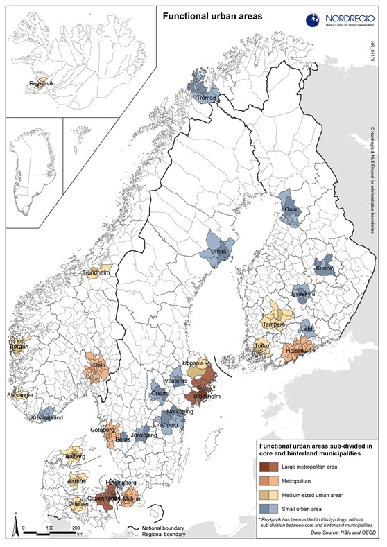
Functional urban areas sub-divided by core and hinterland municipalities
Map Facts
If the OECD’s definition of functional urban areas is used in the Nordic region, almost 55% of the population live in the 30 largest urban functional areas. The population in these areas increased dramatically. Growth varies significantly however between different functional urban areas, from Stockholm (almost 500 000) to Norrköping (10 000). The six metropolitan areas have grown by almost 1.7 million inhabitants. In relative terms, the Greater Reykjavik area and some of the Norwegian urban areas have grown the most, though Stockholm, Malmö and Gothenburg in Sweden and Helsinki and Jyväskylä in Finland have also grown significantly.
All images are the property of Nordregio. They may be freely used as long as the logo of Nordregio is clearly visible and the source is cited accordingly. Please give also the cartographer/designer/author credit and give full recognition to the data sources if named in the graphic.