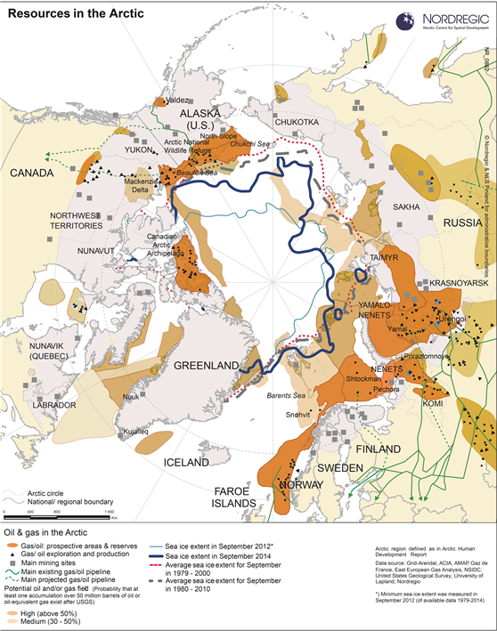
Main sites (both existing and potential) for gas and oil production, including infrastructure, mining sites, and sea ice coverage in the Arctic.
Map Facts
This map shows the different gas, oil, and mining resources in the Arctic. The map also depicts the consistent retreat of ice cover over the Polar Sea during the last few decades. Receding ice cover will influence accessibility to mineral and energy resources both on land and in the Continental Shelf in the future. This map also shows both existing and potential sites of mineral and energy resources in the Arctic region.
Map ID: 0862
Designer/Cartographer
Linus Rispling and Johanna Roto
Data source
Grid-Arendal, ACIA, AMAP, Gaz de France, East European Gas Analysis, NSIDC, United States Geological Survey, University of Lapland, Nordregio
Published 18 June 2015
Terms of use
All images are the property of Nordregio. They may be freely used as long as the logo of Nordregio is clearly visible and the source is cited accordingly. Please give also the cartographer/designer/author credit and give full recognition to the data sources if named in the graphic.