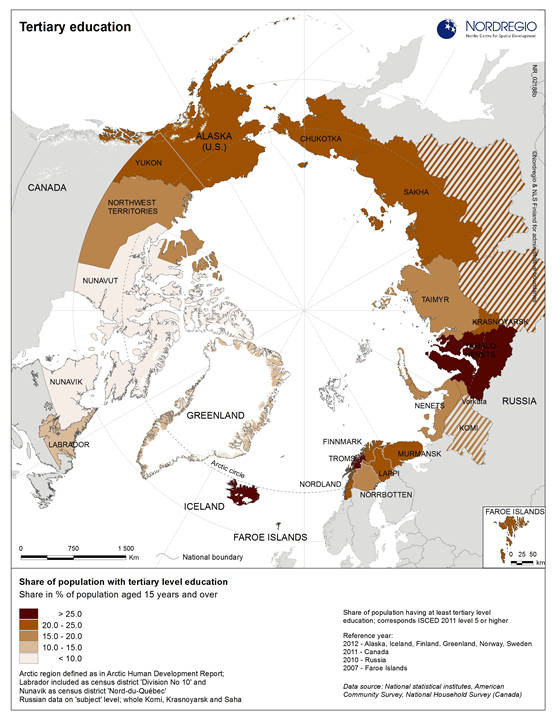
Map showing regional differences in the percentage of people in the Arctic with tertiary level education
Map Facts
The map shows the share of population with tertiary level education indicated by the intensity of the colour scale (darkest indicate higher shares and lightest indicates lower shares). High shares can be seen in regions in Western Canada, Alaska, Troms (Norway) and Iceland in contrast with other areas of the Arctic such as Nunavik and Nunavut (Canada) and Greenland where shares are relatively low.
Map ID: 02188b
Designer/Cartographer
Johanna Roto
Data source
National statistical institutes, American Community Survey, National Household Survey (Canada)
Published 25 February 2015
Terms of use
All images are the property of Nordregio. They may be freely used as long as the logo of Nordregio is clearly visible and the source is cited accordingly. Please give also the cartographer/designer/author credit and give full recognition to the data sources if named in the graphic.