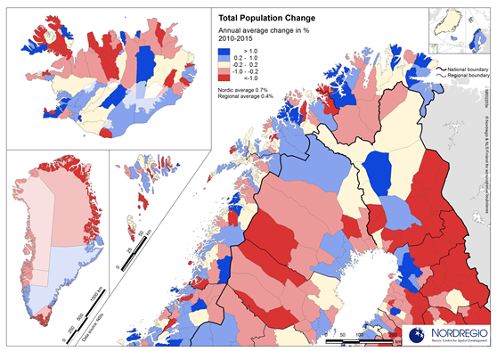
Annual average population change during the five years period in 2010-2015 is showing the diverse pattern of both growing and shrinking regions around the Nordic Arctic Region. Especially the division between growing regional centres and declining small rural municipalities is visible.
All images are the property of Nordregio. They may be freely used as long as the logo of Nordregio is clearly visible and the source is cited accordingly. Please give also the cartographer/designer/author credit and give full recognition to the data sources if named in the graphic.