Nordregio is an international research institute established by the Nordic Council of Ministers

4 February, 2020

People employed in the agriculture, forestry and fisheries sectors (NACE Sector A) in 2017 and 2009-2017 change

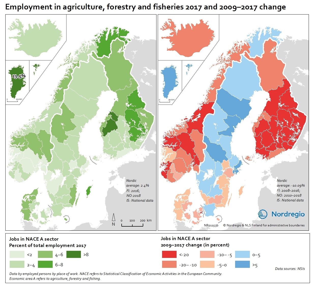
These map show the number of jobs in the agriculture, forestry and fisheries sectors (NACE A sectors) as a share of the total employment in 2017 (left) and 2009-2017 change (right).

The map (left) indicates ranges of people employed in agriculture, forestry and fisheries sectors between below 2% to above 8%, with the highest proportion being in Greenland with 23.5% in 2017. In the EU-28, the overall proportion of the total workforce with jobs in the NACE-A sectors is an average of 4.6%. Overall, the NACE-A sectors show a sharp decline in employment (right map), particularly in Finland, Iceland and Norway (except northern Norway), where the decline was up to 20% between 2009 and 2017.

Read the digital publication here.


Map Facts

These maps are included in the State of the Nordic Region 2020 report.

Read more about it

Designer/Cartographer:
Eeva Turunen

Data sources:
National statistical institutes.

Map ID: NR1153b

Terms of use

All images are the property of Nordregio. They may be freely used as long as the logo of Nordregio is clearly visible and the source is cited accordingly. Please give also the cartographer/designer/author credit and give full recognition to the data sources if named in the graphic.

If you have any questions, contact us:

Email: maps@nordregio.org

Phone: + 46 8 463 54 00

Source: Nordregio at www.nordregio.org