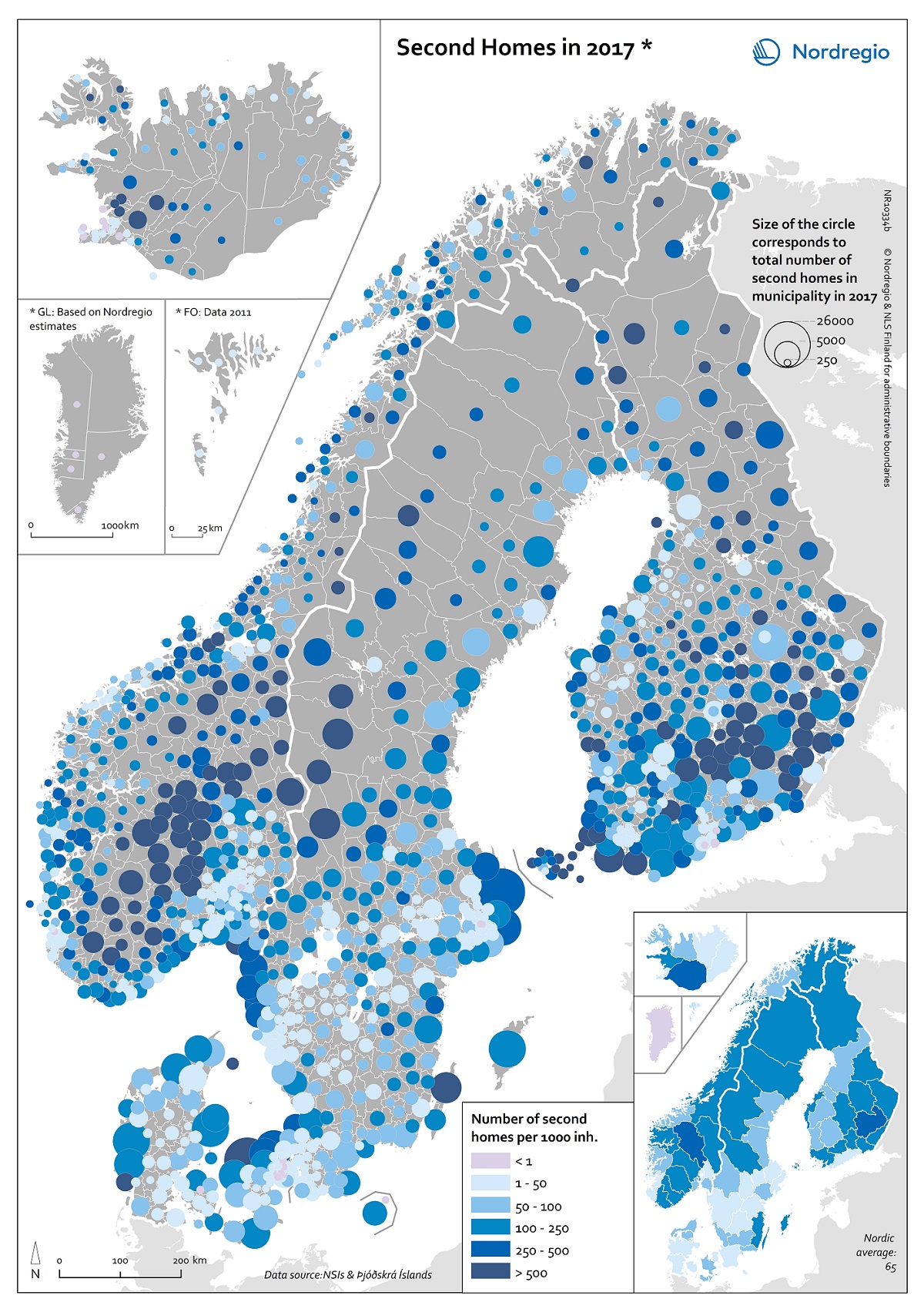
This map depicts the total number of second homes per municipality (size of the circles).
Dark blue indicates higher shares second homes in relation to municipal population and light blue indicates lower shares (purple the lowest). In total, there are 65 secondary homes per 1000 inhabitants in the Nordic Countries. The main areas for secondary homes – both in numbers and in relation to permanent inhabitants are mid-eastern lake areas (Etelä-Savo/Södra Savolax) and south-west archipelago in Finland including Åland, southern mountains area (Dalarna and Jämtland Härjedalen), Stockholm archipelago and Öland in Sweden, southern mountain area in Norway (Oppland and Buskerud), northern Sjælland in Denmark and municipalities in vicinity to Reykjavík in south of Iceland.