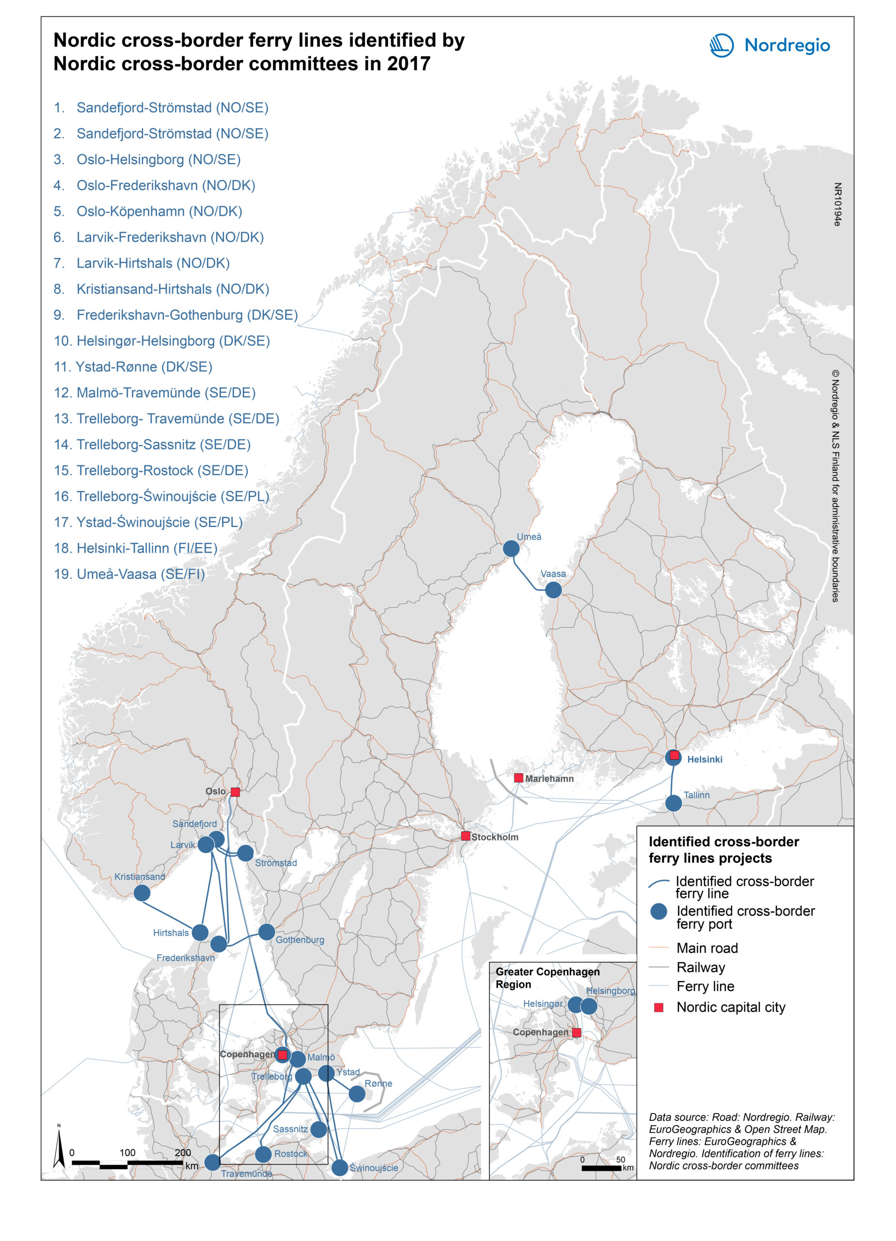
Identified by Nordic cross-border committees in 2017
These cross-border ferry lines are meant to show the importance of further development of movements and infrastructure plans across Nordic national borders, in opposition to infrastructure projects which are drawn up primarily within a national context, without a specific focus on cross-border linkages.
The map shows that the Nordic cross-border committees have identified a number of ferry lines which are considered important for the development of cross-border transport in the Nordic region.
It should be noted that the ferry lines included in the map are solely those identified from the view of Nordic cross-border committees, as examples of ferry lines with potential to further enhance Nordic cross-border ferry line movements at a Nordic level. In the map, there’s no differentiation between the ferry lines other than they have all been identified by cross-border committees. Ferry lines limited to a national context have been excluded from the map, as have those cross-border ferry lines that do not relate to Nordic cross-border committees.
Related:
ARKO
Greater Copenhagen & Skåne Committee
Hedmark – Dalarna
Kvarken Council
Midnordic Region
MidtSkandia
North Calotte Council
Svinesund Committee
Värmland – Østfold