Nordregio is an international research institute established by the Nordic Council of Ministers

4 February, 2020

Urban-rural typology of the Nordic regions 2020

This map is included in the introduction of the State of the Nordic Region 2020 report.

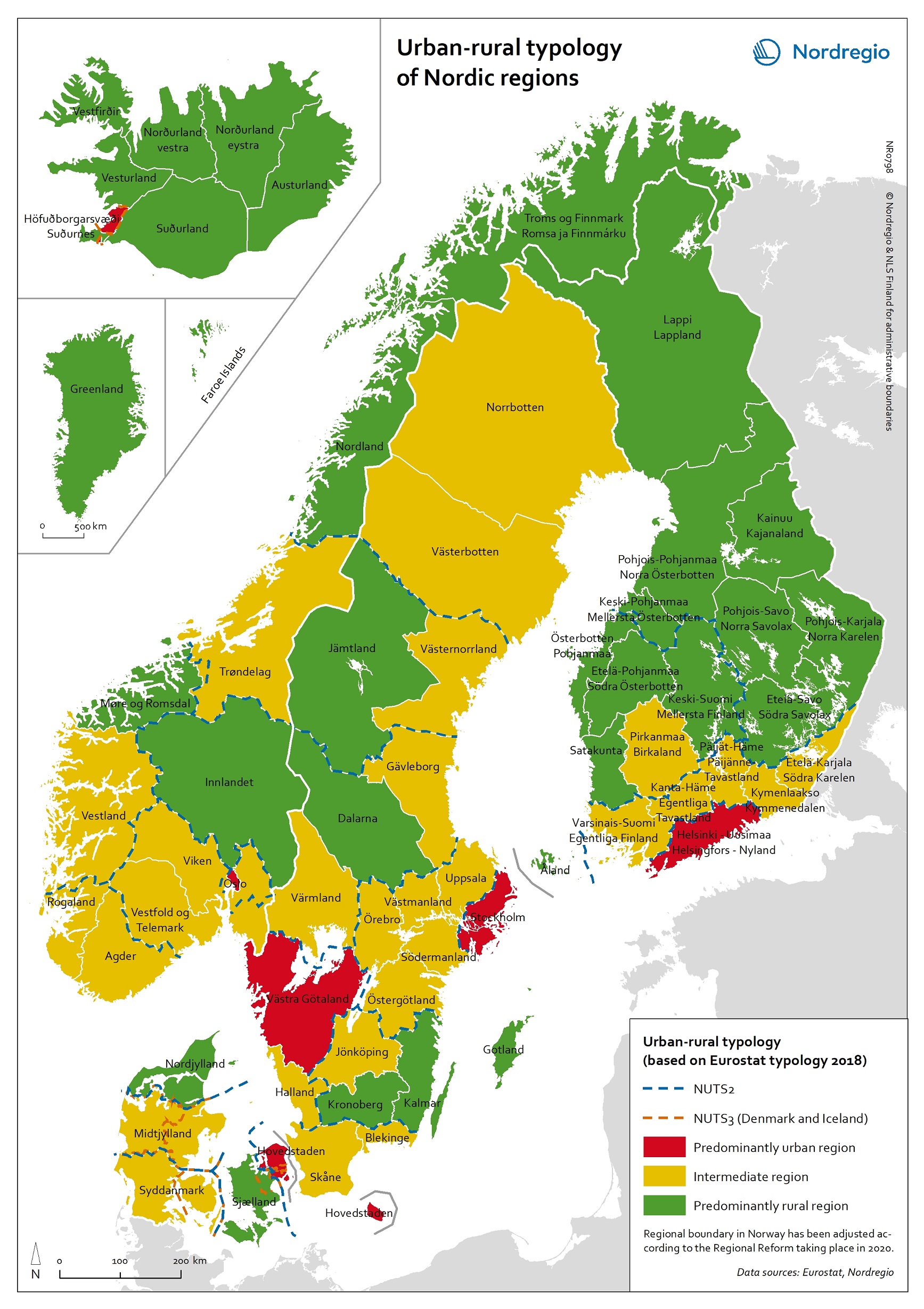
The map is based on the typology provided by Eurostat (2018), in which the 2016 NUTS 3 regions are classified in three categories according to their population density in 2011 and 2015, in 1 km² grids. In predominantly urban regions, at least 80% of the total population is urban, while in intermediate regions, 50–80% of the population lives in urban clusters. In regions that are predominantly rural, less than 50% of the population lives in urban areas.

Read the digital publication here.

Map Facts

The map is included in the State of the Nordic Region 2020 report.

Read more about it

Designer/Cartographer:
Johanna Jokinen

Data sources:
Eurostat and Nordregio

Map ID: NR0798

Published 4 February 2020

Terms of use

All images are the property of Nordregio. They may be freely used as long as the logo of Nordregio is clearly visible and the source is cited accordingly. Please give also the cartographer/designer/author credit and give full recognition to the data sources if named in the graphic.

If you have any questions, contact us:

Email: maps@nordregio.org

Phone: + 46 8 463 54 00

Source: Nordregio at www.nordregio.org