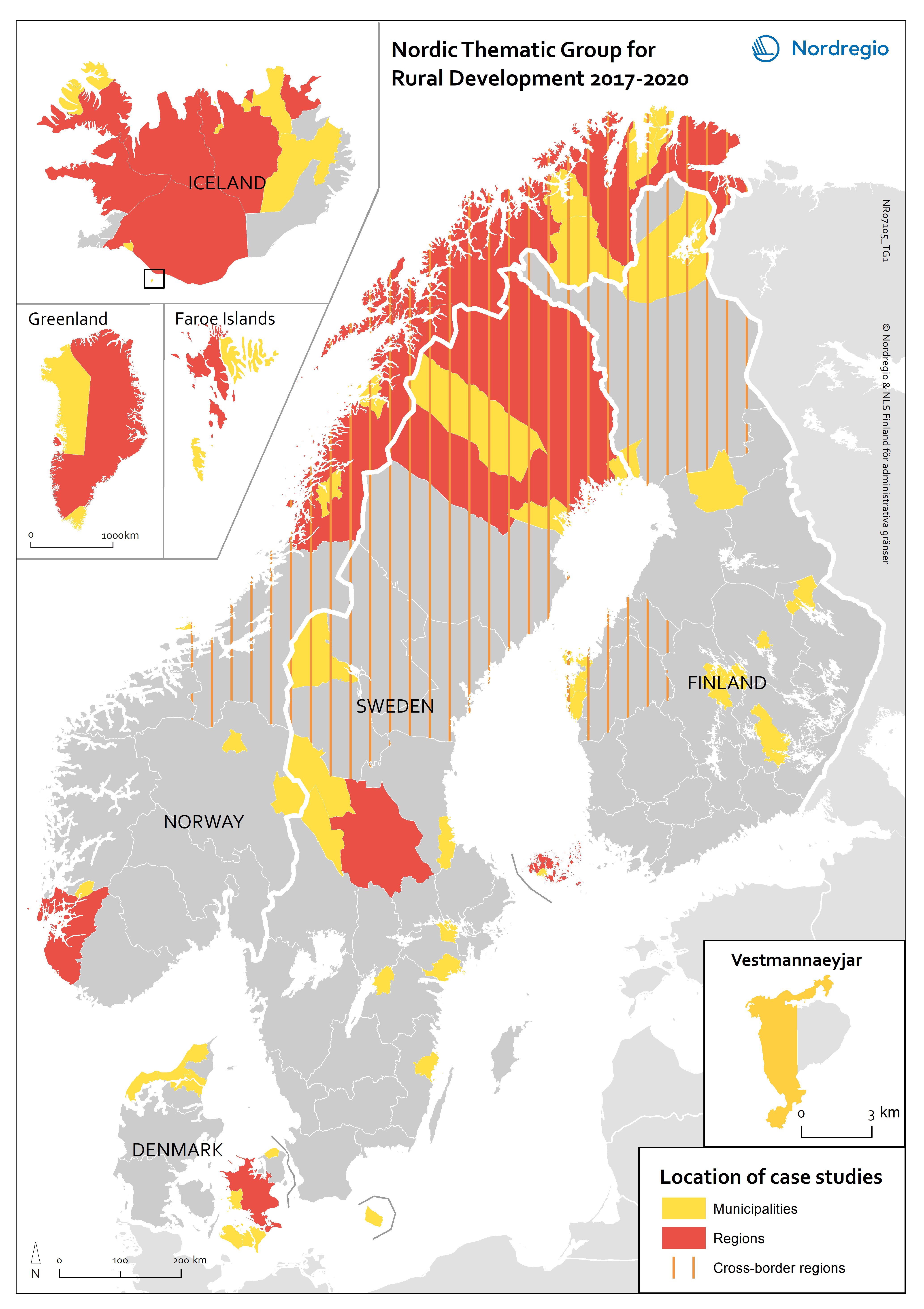
This map indicates the geographical areas involved in case studies and more in-depth research but does not cover municipalities and other areas involved in e.g. questionnaires or more general studies.
18 February, 2021
Designer/Cartographer:
Julien Grunfelder
Data source: Nordregio
All images are the property of Nordregio. They may be freely used as long as the logo of Nordregio is clearly visible and the source is cited accordingly. Please give also the cartographer/designer/author credit and give full recognition to the data sources if named in the graphic.
Source: Nordregio at www.nordregio.org