Identified by Nordic cross-border committees in 2017
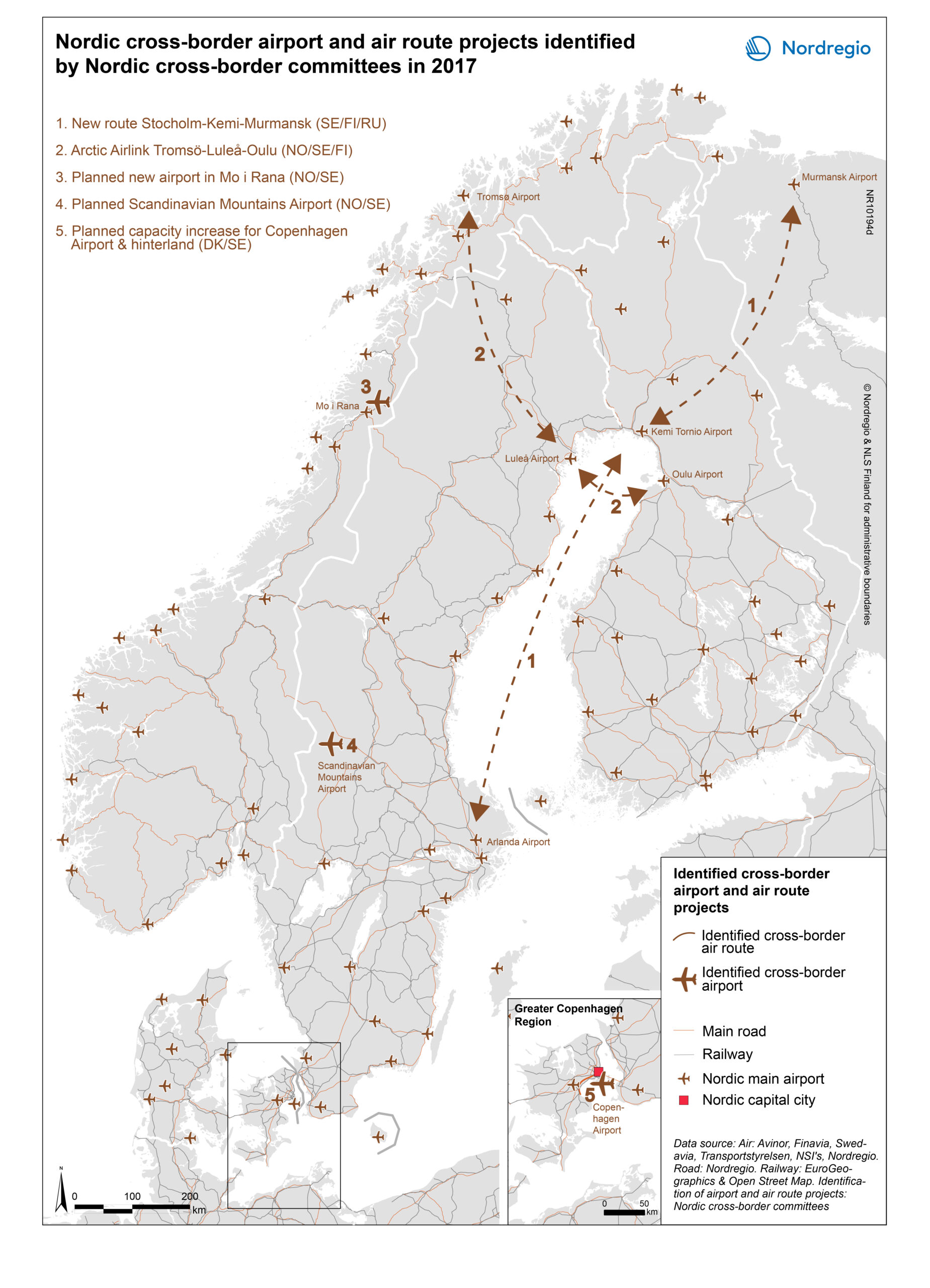
The cross-border airport and air route projects shown in the map highlight the importance of further development of movements and infrastructure plans across Nordic national borders, as opposed to infrastructure projects which are drawn up primarily within a national context, without a specific focus on cross-border linkages. The map shows that the Nordic cross-border committees have identified a number of planned or envisaged cross-border airport and air route projects which are considered important for the development of cross-border transport in the Nordic region.
It should be noted that the airport and air route projects and stretches included in the map are solely those identified from the view of Nordic cross-border committees, as examples of projects with potential to further enhance Nordic cross-border airport and air route movements at a Nordic level. In the map, there’s no differentiation between already planned and visionary projects; nor between local and global cross-border projects, or between projects with a limited geographic coverage and generic, large-scale infrastructure corridors. Envisaged or planned airport and air route projects limited to a national context have generally been excluded from the map, as have those cross-border projects that do not relate to Nordic cross-border committees.
Read more about this:
ARKO
Greater Copenhagen & Skåne Committee
Hedmark – Dalarna
Kvarken Council
Midnordic Region
MidtSkandia
North Calotte Council
Svinesund Committee
Värmland – Østfold