The map illustrates the accessibility of primary care in Västerbotten in Sweden. The colours represent car ride times in minutes from the place of residency to the nearest health care facility within a certain service type, with a travel range of 10 minutes to two hours. The health care facilities are also located on the map.
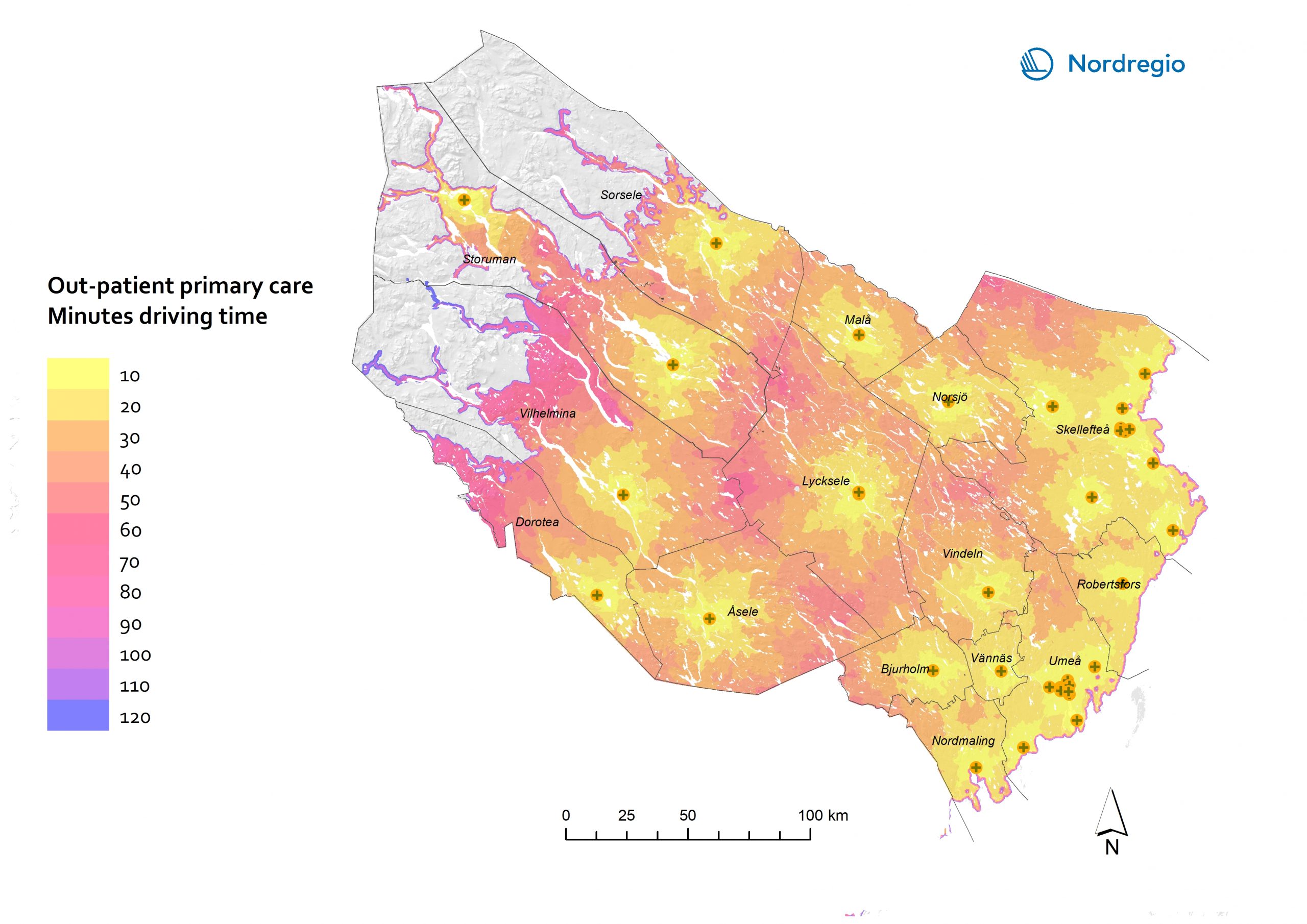
The 37 health care facilities in the region contribute to widespread coverage of primary outpatient care for the population in Västerbotten. Over 80% of the inhabitants can access such health care services within a 10-minute car ride, and a half-hour car ride can cover 95.8% of the regional population. In general, coastal municipalities have easier access to health care services than inland municipalities. As one of the inland municipalities, Storuman accommodates one health care facility which provides most of the health care services expected in relation to highly
specialised care.

