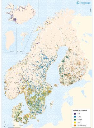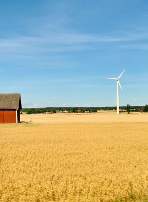
Summer is here and so is Nordregio’s summer map of 2026! Nordic people enjoy spending summer in nature, whether it is by a lake, in the forest, on the beach or in the fell. These summer pastimes are also evident in the streets we walk in our daily lives.
I can see no better way to start the summer than diving headfirst, not into a lake, but into the Nordregio summer map! says Benjamin Ullman, cartographer and junior GIS-analyst at Nordregio.
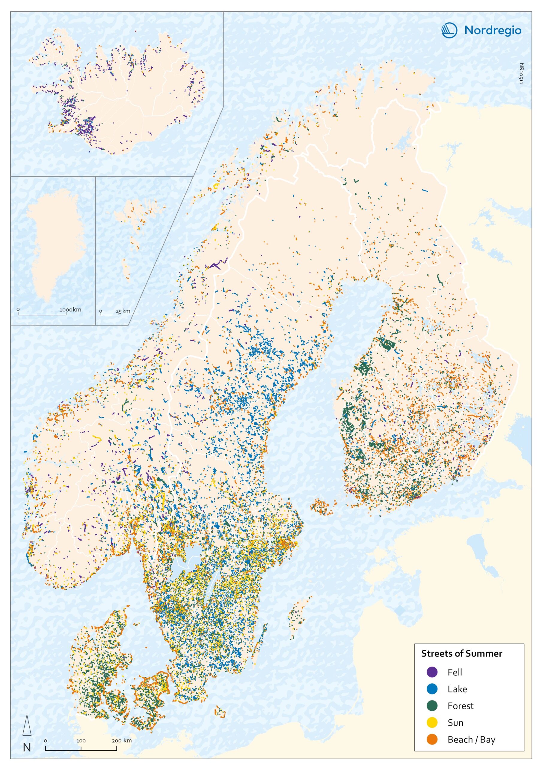
The summer map 2026 shows streets in the Nordic Region with the words beach/bay, sun, lake, forest and fell in them.
Lakes in Sweden, Forests in Finland
Sweden has the most street names with lake in them, most in the regions of Småland, Västra Götaland and the southern parts of Norrland. Finland have a large concentration of streets with forest in their name, mainly in clusters on the west coast. Iceland has a lot of street names with fell in them.
Street names with beach or bay in them are mainly clustered along coastlines. That is evident along the coast of Denmark, particularly on Sjælland, and in Sweden along the coast of Skåne. Finland on the other hand is more liberal in naming streets with beach or bay, having such streets all over the country.
100 000 summer streets
It is hard to give an exact estimate, but approximately 100 000 streets in the Nordic Region have names connected to our favorite summer pastimes. Nordregio’s summer map 2026 – streets of summer – show where they are and what they are named after.