The map illustrates the accessibility of primary care in Nordjylland in Denmark. The colours represent car ride times in minutes from the place of residency to the nearest health care facility within a certain service type, with a travel range of 10 minutes to two hours. The health care facilities are also located on the map.
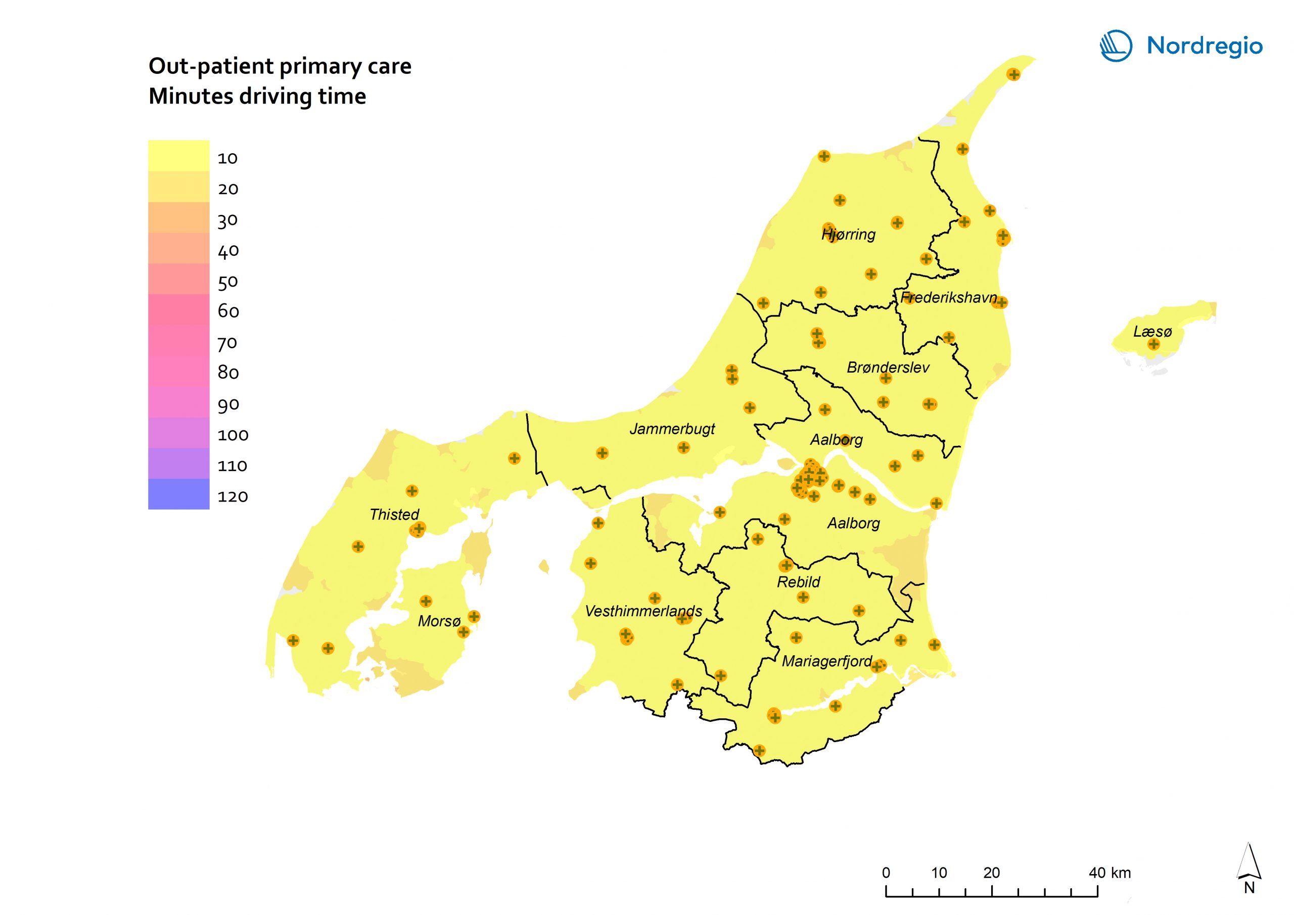
Accessibility to primary out-patient health care services in Nordjylland is outstanding. Altogether, 98.7% of the population can access one such service within a ten-minute ride, while a 20-minute ride covers 99.8% of the total population in the region. In total, 165 health care facilities provide primary health care in the region, contributing to an established pattern of extensive accessibility across Nordjylland.

