The map illustrates the accessibility of primary care in Eastern health region in Iceland. The colours represent car ride times in minutes from the place of residency to the nearest health care facility within a certain service type, with a travel range of 10 minutes to two hours. The health care facilities are also located on the map.
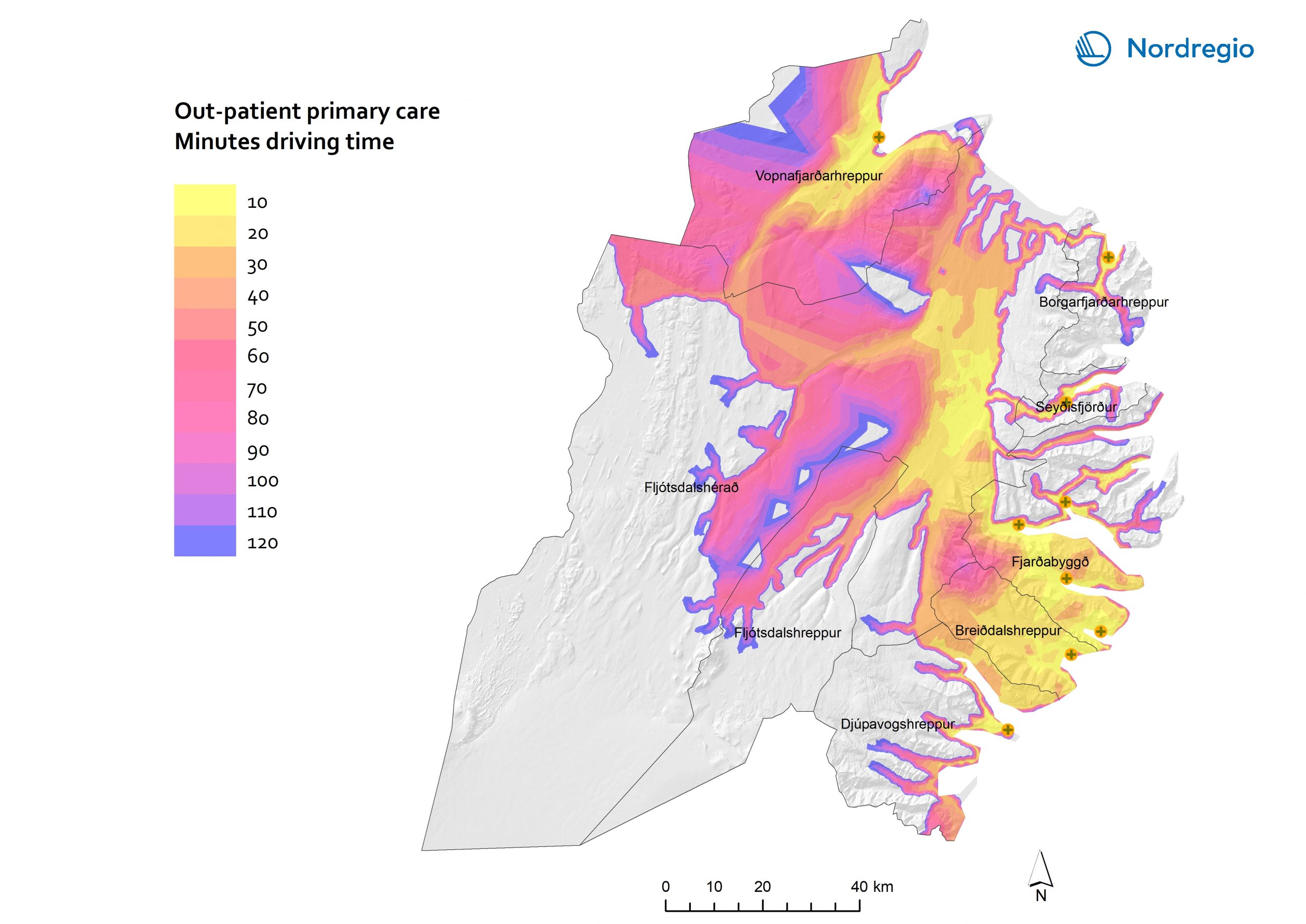
Fjarðabyggð municipality accommodates five of the 11 facilities. All the other municipalities, apart from Fljótsdalshreppur, accommodate one health care facility each. Primary out-patient care is available in all the 11 health care facilities, covering 65.7% of the regional population within
a 10 minute car ride. A large majority of inhabitants (87.7%) across the region can access primary care within a half-hour car ride, and a one-hour car ride covers a 97.5% of the regional population. Accessibility in Fjarðabyggð is relatively extensive, with five primary care facilities.
Despite Fljótsdalshérað only accommodating one primary care facility, inhabitants have easy access to the service, since the facility is located in the most densely populated part of the municipality.

